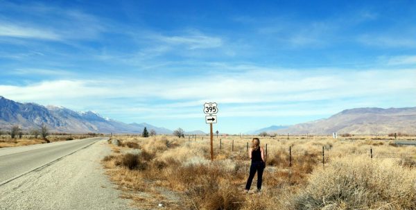
Any solo female traveler can tell you, it’s easy to fall in love on the road. Maybe with a sexy stranger, maybe with the #2 combo at a roadside burger stand, maybe with a whole new city. Yes, it’s easy to fall in love ON the road, but traveling on Highway 395 in eastern California might make you fall in love with the road itself.
From the highest point in the contiguous U.S (Mt. Whitney), to many beautiful lakes and hot springs, to appalling but important U.S. history, to charming towns and into the Mojave Desert, Highway 395 has so much to offer travelers. You could make the drive in a day, but four or five would be a lot better! Make it a whole week if the season is right and you can veer off to Tioga Pass and visit Yosemite National Park.
For lodging, there are plenty of options in the towns, and there are no stretches for more than about an hour and a half lacking basic services. You might stay in Susanville, Mammoth Lakes, Bishop or Lone Pine. The only cities on this route are in Nevada — Reno and Carson City. There are plenty of National Forest and Bureau of Land Management (BLM) camping options on this route. That means there are plenty of hiking spots as well.
Here’s what you may see and where you might like to hike, north to south, on a Highway 395 road trip in California and Nevada.
Susanville, California
Start your trip in Lassen County, California, in the northeast corner of the state. Susanville is a small town with a big reputation for outdoor activities (and a few prisons). There are many hiking, biking, skiing and OHV trails for you to explore here, where the Sierra Nevada Mountains, the Cascade Mountains and the Great Basin converge.

Go for a ride or hike in Susanville Ranch Park (pictured directly above) without ever really leaving town, and check out the Canyon Trail. Through and beyond Susanville, the Bizz Johnson National Recreation Trail is famous for over 25 miles of biking, hiking and cross-country skiing.
Reno, Nevada
It’s only an hour and a half drive from Susanville to Reno south on Hwy 395, but it will fly by if you are busy enjoying the scenery.

To the west is the Plumas National Forest, and to the east are some stunning mountain range views like the Fort Sage Mountains and the Skedaddle Mountains, pictured above reflecting on Honey Lake. Hit the BLM OHV trails around Fort Sage; bike or hike up Bald Mountain; and hike or boat around Antelope Lake.
Past Reno, you might take a slight detour to Virginia City and Storey County which are part of a National Historic Landmark District preserving the opulence of this Old West mining towns. Or stop in Nevada’s capital, Carson City, and veer west here to get to Lake Tahoe.
Mono Basin, California
Next on Hwy 395, you’ll drive through Gardnerville, Nevada and pass Topaz Lake before you cross back into California. Remember, if you stopped in Nevada for any fruit or flowers, you will not be able bring them across the border. The State of California protects natural resources by preventing the spread of exotic invasive species through live plant material. So, if you picked up some produce in the Carson Valley or are relocating with your favorite houseplant, be prepared at the border crossing.
The next thing to be on the lookout for is the “Scenic Viewpoint” sign about 15 minutes south of Bridgeport. It comes just before a parking lot on the outside of a curve. You won’t be sorry for the slowdown when you catch the incredible view at Mono Lake Vista Point (pictured above).
If you are staying in the area, be sure to get camping and other federal recreational information at Mono Basin National Forest Scenic Area Visitor Center. On the state government level of public lands, Mono Lake Tufa State Natural Reserve (pictured below) offers ecological history beyond compare.

This one-million year old saltwater lake, once an ancient inland sea, is home to 1-2 million birds and limestone spires called “tufa towers.” It was only three dollars for entry. Note: locals pronounce Mono as “MOE-know,” not “MA-know,” Lake and Basin.
Tioga Pass & Yosemite Detour
Just after the town of Lee Vining, you can take State Route 120 west into Yosemite National Park. This is called Tioga Pass, and it is only open for about one-half of the year due to heavy snow pack on the road. You’ll be able to drive it from May or June through October or December. It’s a beautiful drive, but it’s not for the faint at heart. If you are inexperienced driving in the mountains without guardrails, please take this route slow and steady. In high tourist season, there will be such a line of traffic that you won’t have a choice!

The end of the line of Tioga Pass is called Tuolumne Grove, and this short, groomed hiking trail will take you around and literally through some amazing giant sequoia trees. If you can’t make it over to the western side of the Sierras to the Mariposa Grove of Yosemite, Kings Canyon or Sequoia National Parks, this is the perfect way to experience the splendor of these huge trees.
At this point, you’ve probably been on the road and on the hiking trails for several hours! Whether you want to ski, hike, take pictures or shop, the town of Mammoth Lakes will be a sweet respite.
Rest up and get ready for Part II of Trailheaders’ “Hiking and Road Tripping Hwy 395 Along the Eastern Sierras,” coming next week.
Wishing you safety, independence and joy on your road trip! Comment below or on Trailheaders Travels and Hiking on Facebook if you’ve ever experienced Hwy 395!

Your voice matters!